
Region
Big Sur Highway 1
Plan a scenic Highway 1 drive around current road conditions, park access, viewpoints and overnight stops. Check official alerts before setting the route.
- Guides
- 1
- Checked places
- 4
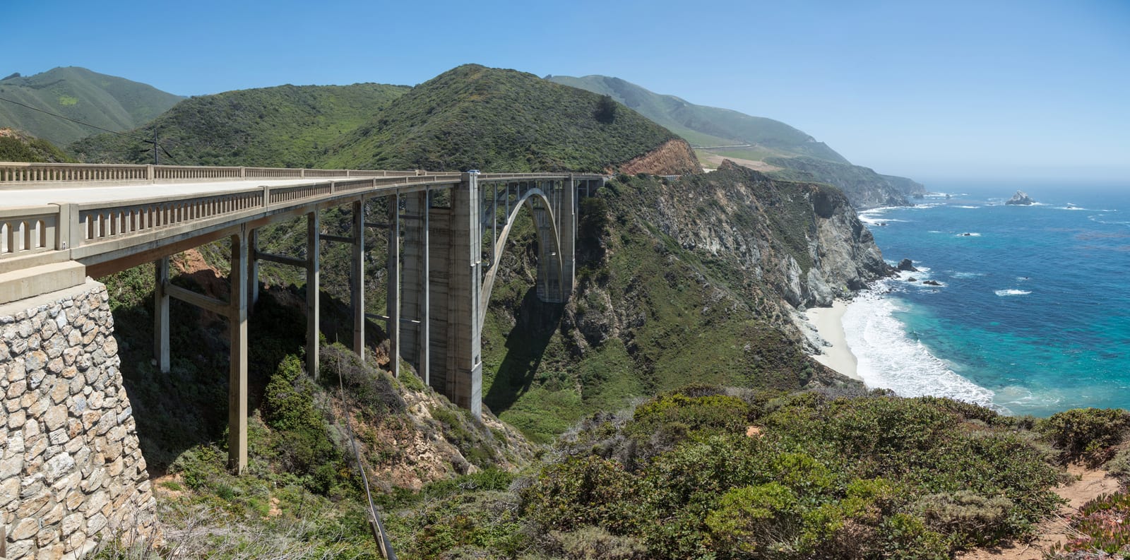
Image: Bixby Creek Bridge, Big Sur | Photo by Diliff on Wikimedia Commons | CC BY-SA 3.0
Where to stay
Compare places to stay around Big Sur Highway 1
Compare current accommodation prices around Big Sur Highway 1 for your dates.
Partner map by Stay22. We may earn a commission on bookings at no extra cost to you. Prices and availability depend on your dates; check the property’s location and cancellation terms before booking.
Map
Map of Big Sur Highway 1
The map places Big Sur Highway 1 and its checked places in California; use it to compare travel distances between the coast, wine country, islands, mountains, and desert.
Loading the visitor map…You can also choose an area from the list below.
California regions
1SausalitoGolden Gate ferry day-trip town with a Bridgeway waterfront, Fort Baker, and the Army Corps Bay Model.2YountvilleDestination-dining base in the Napa Valley, home to The French Laundry and Domaine Chandon.3St. Helena / CalistogaUpvalley wine-country towns with historic wineries, a castle, spas, and the Old Faithful geyser.4South Lake TahoeTwo-season lake and ski base on the California shore, with Emerald Bay and Heavenly Mountain Resort.5MendocinoNorth Coast bucket-list village wrapped by headlands, with a lighthouse and redwood-canyon parks.6Cannery RowAquarium and Steinbeck waterfront corridor along Monterey Bay, from Cannery Row to Fisherman's Wharf.7CarmelTiny coastal town of galleries and inns beside Carmel Beach, the Carmel Mission, and Point Lobos.8Big SurThe cliff-hugging Highway 1 drive past McWay Falls, redwood state parks, and Nepenthe.9Santa BarbaraDowntown State Street and the waterfront, with the Old Mission, Stearns Wharf, and the courthouse.10Santa Monica / VeniceLA coastal neighborhoods from the Santa Monica Pier and Pacific Park to the Venice boardwalk.11AvalonFerry-and-island escape to Avalon, with the Casino landmark, Wrigley Garden, and Descanso Beach.12La Jolla CoveSan Diego coastal cove for snorkeling and sea lions, near Birch Aquarium and Torrey Pines.13Palm SpringsMid-century desert-resort core with the Aerial Tramway, Art Museum, and design shopping.
A practical plan for this area
Choose Monterey or Carmel as a flexible base while checking which part of Big Sur is actually accessible. Plan one confirmed out-and-back section and a meal only after checking the road and venue. A coastal map does not establish a continuous through-route.
Getting there and back
Check Caltrans before leaving and again before the return. Save the permitted turning point and keep enough fuel and daylight for the route back. Follow official closures and evacuation directions; a navigation app is not permission to enter a closed road.
Before you book
State Parks lists day-use areas, the campground, selected trails and Big Sur Lodge for reopening from October 16. Other named trails remain closed. Check current park and road access, then confirm the lodge’s own availability before reserving.
If plans change
Use Monterey Aquarium or a Carmel town day when the coast route cannot be completed safely. Change the overnight plan before driving south rather than relying on a hotel inside an affected area.
Plan reviewed:
Guides
California planning guides
Planning categories
Hotels, restaurants and things to do in Big Sur Highway 1
Checked visitor places
Places to visit
State Park redwood lodgeBig Sur LodgeRustic cottage-style rooms among the redwoods inside Pfeiffer Big Sur State Park, with a restaurant and store on site — the overnight that puts you on the Big Sur coast before and after the day-trippers. Checked October 23, 2026: State Parks lists a partial reopening from October 16 for day use, the campground, selected trails and Big Sur Lodge; several named trails remain closed. Check current park and road access and confirm lodge availability before travelling or booking.State parkJulia Pfeiffer Burns State ParkThe Big Sur state park famous for McWay Falls, an 80-foot waterfall dropping to a cove beach, off Highway 1 about 37 miles south of Carmel. Checked October 10, 2026: Julia Pfeiffer Burns is only partly open. Trails east of Highway 1 are closed, the McWay Falls Overlook Trail is closed for a retaining-wall project, and there is no beach access.Cliffside restaurantNepentheA landmark clifftop restaurant open since 1949, perched on the ocean side of Highway 1 with sweeping Big Sur coast views and the casual Cafe Kevah and Phoenix shop below.State parkPfeiffer Big Sur State ParkA redwood-shaded valley park on the Big Sur River with day-use trails, the Big Sur Lodge, and campgrounds — the main inland base for exploring the Highway 1 corridor. Checked October 23, 2026: State Parks lists a partial reopening from October 16 for day use, the campground, selected trails and Big Sur Lodge; several named trails remain closed. Check current park and road access and confirm lodge availability before travelling or booking.
Curated events